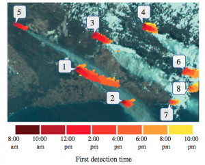
使用Himawari-8卫星进行实时火灾监测
文章发表于:Remote Sensing Letters, Volume 8, 2017 – Issue 11
原文地址:Real-time wildfire detection and tracking in Australia using geostationary satellite: Himawari-8
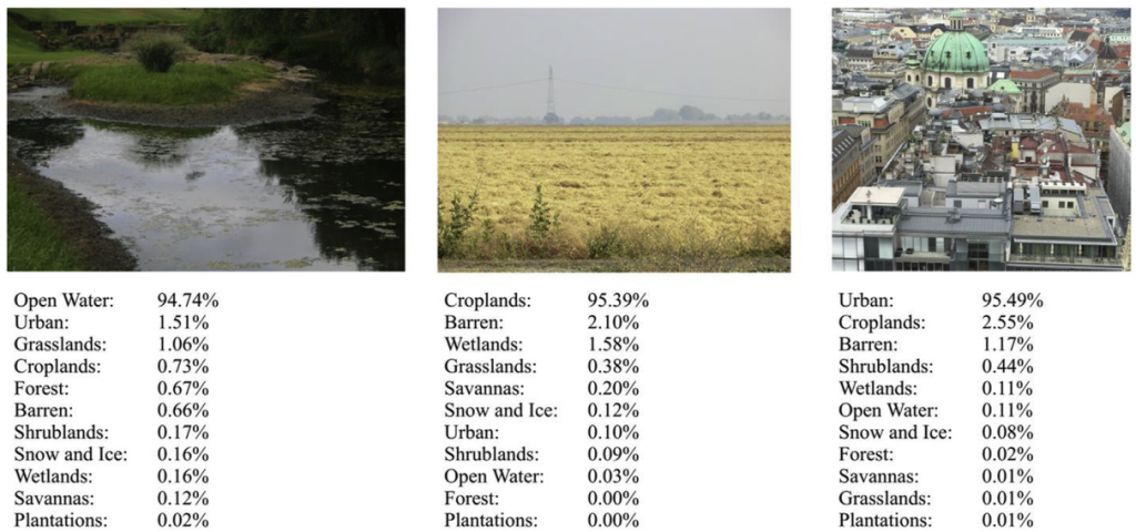
使用迁移学习识别普通照片的土地覆盖类型
文章发表于:Environmental Modelling & Software, Volume 91, May 2017, Pages 127–134
原文地址:Automatic land cover classification of geo-tagged field photos by deep learning
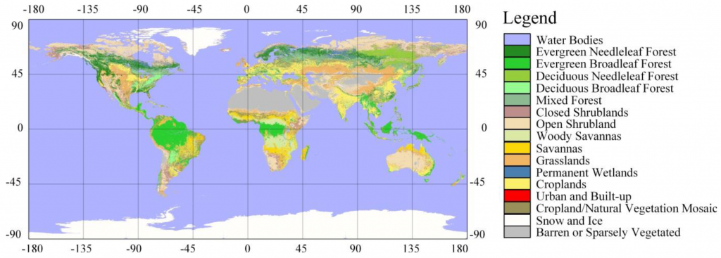
使用贝叶斯理论进行土地覆盖地图融合
发表于:Remote Sensing 2014, 6(6), 5589-5613
原文地址:A Bayesian based method to generate a synergetic land-cover map from existing land-cover products